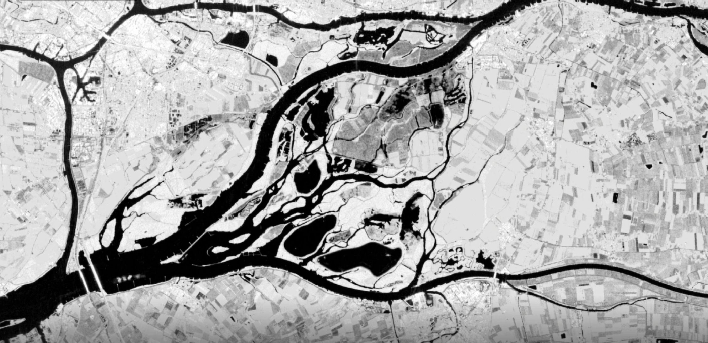
Satellite images of the before and after situation of the Noordwaard polder in the Biesbosch. The dark patches are where the water is flowing to (on purpose)
In the area, water is collected from the river Boven Merwede due to the high water level.
The water of the Merwede enters the Noordwaard, a polder near the Biesbosch. As a result, the level of the river drops about 30 centimeters and residents of cities such as Gorinchem and Dordrecht keep their feet dry.
The Noordwaard has been a so-called through-flow area since 2015. The dikes are 2 meters above sea level. When the water rises, it automatically flows into the polder. It is arranged in such a way that the roads and houses remain dry. Residents therefore do not have to leave. The river will get an extra route to Haringvliet and the North Sea. De Noordwaard is one of the largest projects in the government program Room for the River, which was set up after the floods of 1993 and 1995.
The fact that the water levels are so high is because the rivers have to drain a lot of rainwater from Germany and France. At the same time, the water from the southwest is pushed up by the Ciara storm.
The level of the Merwede will probably fall in a few days the water will no longer enter the polder then.


